|
Location, Land Use,
Political Subdivisions:
The
municipality of Guinayangan is one of the thirty nine
municipalities comprising Quezon Province.
It is
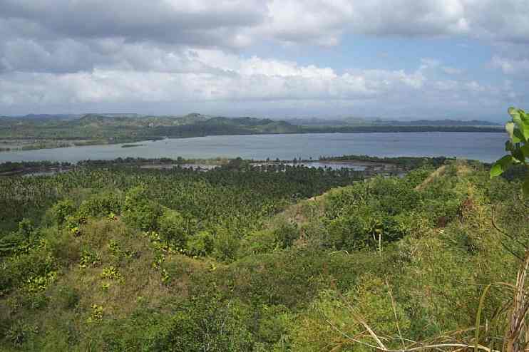
located on the southeastern part of the province, at
the east coast of Bondoc Peninsula facing the province
of Camarines Sur.
It is
bounded on the east by Ragay Gulf, on the west by the
municipality of Lopez, on the north by the
municipality of Calauag and partly by a navigable
river of Vińas and on the south by the municipality of
Buenavista. It is about 132 km. from the provincial
capital, Lucena City and about 255 km. from Metro
Manila.
It is
comprised of fifty four barangays and has a total land
area of 22,800 hectares.
Climatic and
Geographical Characteristics:
 The
municipality is generally hilly and mountainous and
some barangays are located in the coastal areas. The
municipality is generally hilly and mountainous and
some barangays are located in the coastal areas.
The
Climate in the area falls under Type IV Category (as
classified by CORONAS) were rainfall is more or less
evenly distributed throughout the whole year.
The
computed mean annual precipitation based on isohyetal
map is 2,600mm. The maximum precipitation occurs in
October at an average of 450 millimeters while minimum
precipitation occurs in April with an average of 78
millimeters. Dry months are recorded in the months of
February to August and wet months are recorded in the
months of September to January.
The
temperature in the area ranges from 21 şC to 33 şC.
the warmest months are from March to May while the
coolest period is from December to January.
The
climate affects the living condition of the populace
especially during heavy downpour, where floods and
soil erosions on some part of the municipality occur during this season.
Social Profile:
Based
on the latest Census of population conducted by the National Statistic Office
(NSO) in May 2020, the municipality is inhabited
by a total of 44,045, of which approximately 22,234 are males
and 21,811 are females. It has a ratio of almost 1:1 which means
that the labor force in the area can come from both
gender.
The
2015 Census of Population revealed that the
municipality has a total of 45,155 inhabitants
compared to 44,045 as recorded for the year 2020 or an
average annual population growth rate of -0.0050% for
that period. This is lower than the 1.13% annual
growth rate registered between the 2020-2030 period.
The May 2010 Census showed that there are 8,961
households in the municipality or an average of almost 5
members per household. Projected population
for CY 2025 is computed at 43,516. The inhabitants of the
area are generally Tagalogs, Batangueńos, Caviteńos
and Bicolanos. Tagalog is the predominant dialect.
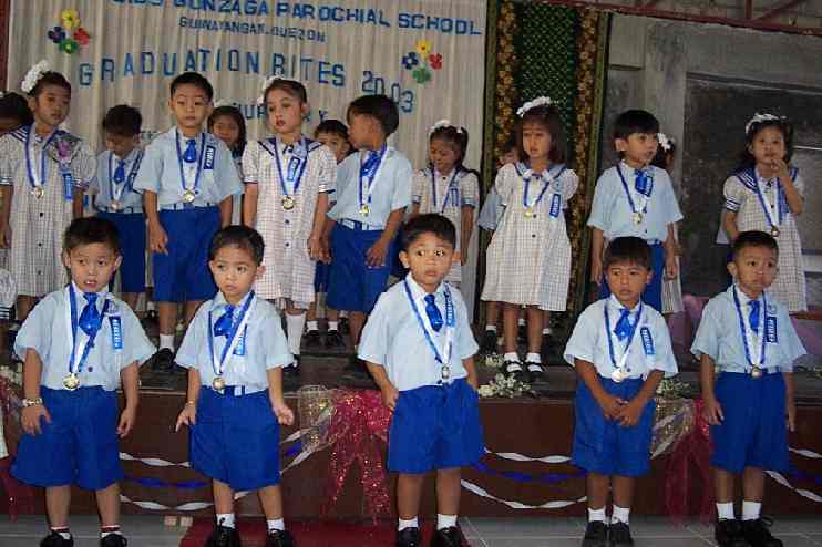
 Basic
literacy rate was relatively high at 97 percent as of
2020. In absolute terms, 97 percent of those aging 10
years and above where able to read, write and
compute. The urban literacy rate was higher at 98
percent while the rural literacy rate was recorded at
97 percent. Basic
literacy rate was relatively high at 97 percent as of
2020. In absolute terms, 97 percent of those aging 10
years and above where able to read, write and
compute. The urban literacy rate was higher at 98
percent while the rural literacy rate was recorded at
97 percent.
Over-all health facilities and performance indicators
revealed an improving health condition in the
municipality, albeit moderately. Except for infant
mortality rate where an erratic case was noted, other
indicators such as crude death rate, maternal
mortality and neonatal deaths had been gradually
reduced. In like manner, health personnel complements
such as doctors, nurses and midwives appear to be
adequate if taken together.
Just
like in any other towns in the country, Roman Catholics account
for majority of the population which in Guinayangan is
recorded at 93% of the populace. The rest belong to
other churches such as Iglesia ni Cristo, the
Protestant Churches and Islam.
Based
on the latest available labor and employment figure, the total
labor force was posted at 20,585 with 94 percent
employment rate. Of the 20,354 employed, 51 percent
were absorbed by the agricultural sector while the
remaining 49 percent were working for the
non-agricultural sector.
Power and
Electricity:
Electric power for Guinayangan is distributed by
Quezon Electric Cooperative (QUEZELCO I). As of
the latest available data, Quezelco I effective coverage in the municipality is 100
percent of the total number of barangays but in 2010 only
about 5,840 households are energized which is 65.17
percent of the total households in the municipality.
Communication
Facilities:
The
KABALIKAT CIVICOM is responsible
for transmitting, receiving and providing radio
communication services to the public. It
has a transmitter station at the Poblacion which
relays the inter-provincial telegraph
system. A
telegraph station with a radio and HF/CW facility
serves the municipality. Supplementing these are
VHF/UHF radio communication equipments located at the
municipal building for emergency purposes and
connecting barangay communications. Guinayangan receives regular television
broadcasting from Gulf Side Video Network (GVN).
 The
municipality has one postal office located at the
municipal public market site. It is managed by the Philippine Postal
Corporation.
The location of the postal office at barangay Calimpak makes it accessible to both northern and
southern sections of the town. The
municipality has one postal office located at the
municipal public market site. It is managed by the Philippine Postal
Corporation.
The location of the postal office at barangay Calimpak makes it accessible to both northern and
southern sections of the town.
Telephone services are extended by PLDT though it has
no branch office in the area.
The system provides the subscribers with domestic
long distance and overseas telephone calls as well as
internet services.
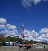
Two 60m high GLOBE GSM Tower were erected
to provide mobile phone services. One is located at
the town proper and one is located at Barangay Sta.
Cruz which serve as relay station of other GLOBE GSM
Towers in the nearby municipalities of Tagkawayan, Calauag
and Lopez. A 45m high SMART Tower is also
erected at Barangay Calimpak just a few meters from
the municipal cemetery. A 45m high SUN CELLULAR
Tower also exist in the municipality. Its tower
is located in brgy. Himbubulo Este. Sometime in late
1990's the presence of Telepono sa Barangay Project
of the Department of Transportation and Communications
(DOTC) exists in the 10 most highly populated Barangays in the
municipality that include among others the rural
Barangays of Aloneros, Gapas, Sintones, Arbismen, and
Capuluan Tulon. Telepono sa Barangay Project is
not operational now.
Economic Profile:
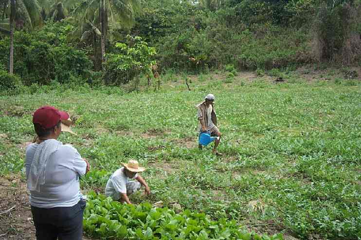
Guinayangan is primarily an agricultural municipality
with 68 percent of its total land area devoted to
agricultural production. Fish production is another
major economic activity of the municipality’s 15
coastal barangays.
 The
major crop grown is coconut with 79 percent of the
total agricultural land uses devoted to coconut
production. Other crops grown in the municipality are
corn, rice, banana, citrus, rootcrops, vegetables and
coffee. Majority of the farmers are also raising
livestock and poultry for family consumption and also as a source of additional income
for their families. Other existing animal productions
are
basically for home consumption. The
major crop grown is coconut with 79 percent of the
total agricultural land uses devoted to coconut
production. Other crops grown in the municipality are
corn, rice, banana, citrus, rootcrops, vegetables and
coffee. Majority of the farmers are also raising
livestock and poultry for family consumption and also as a source of additional income
for their families. Other existing animal productions
are
basically for home consumption.
There
are only a few types of economic support facilities
and institutions or tertiary level sectors in
Guinayangan. These are the wholesale and retail
subsector, transportation, communication and storage,
financial institutions and business services, and
community, social and personal services subsector.
There
are only few financial institutions in the
municipality. The only savings and loan services
available in the locality are the ones provided by the
Quezon Capital Rural Bank (QCRB - Guinayangan Branch)
and by the Rural Bank of Atimonan, Inc. (Guinayangan
Branch).
|